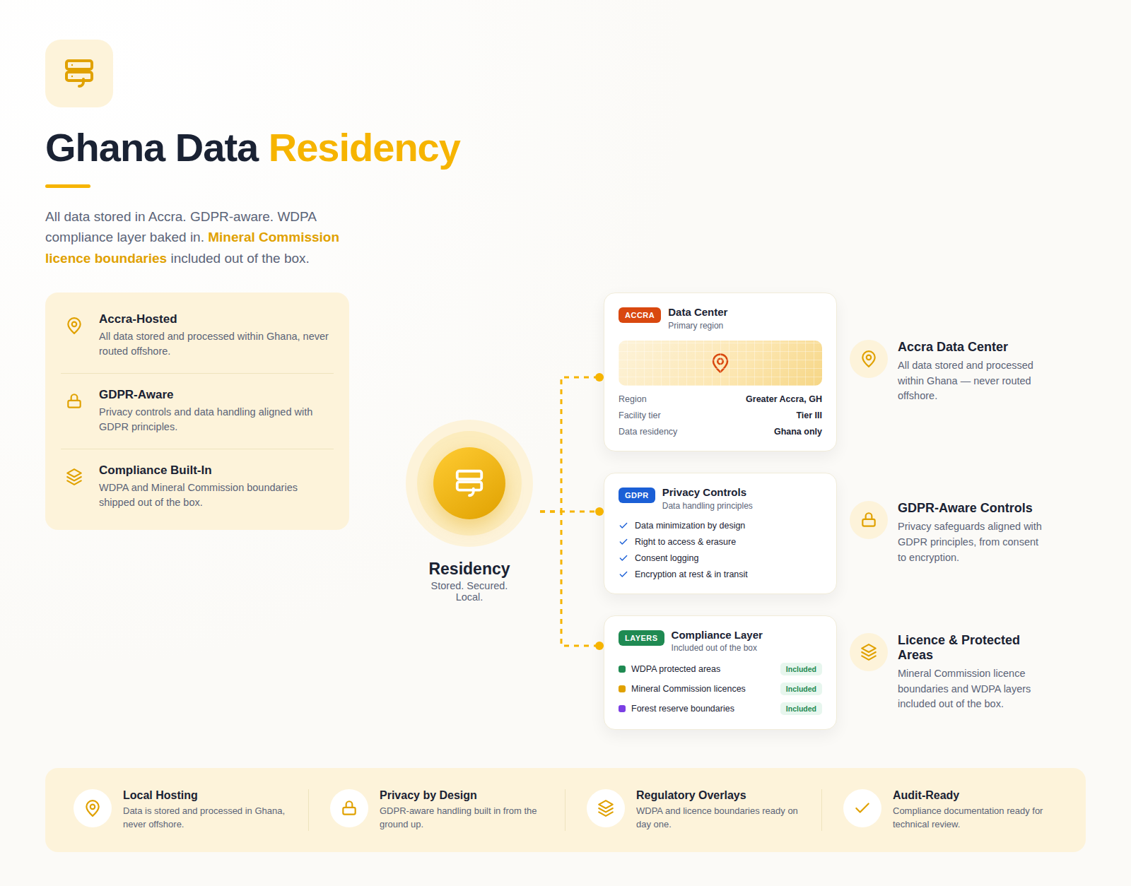
The Process
From raw data to
drill-ready targets
Four stages. Fully traceable. Accepted by QPs. Built for orogenic gold and West Africa's Birimian geology.
01
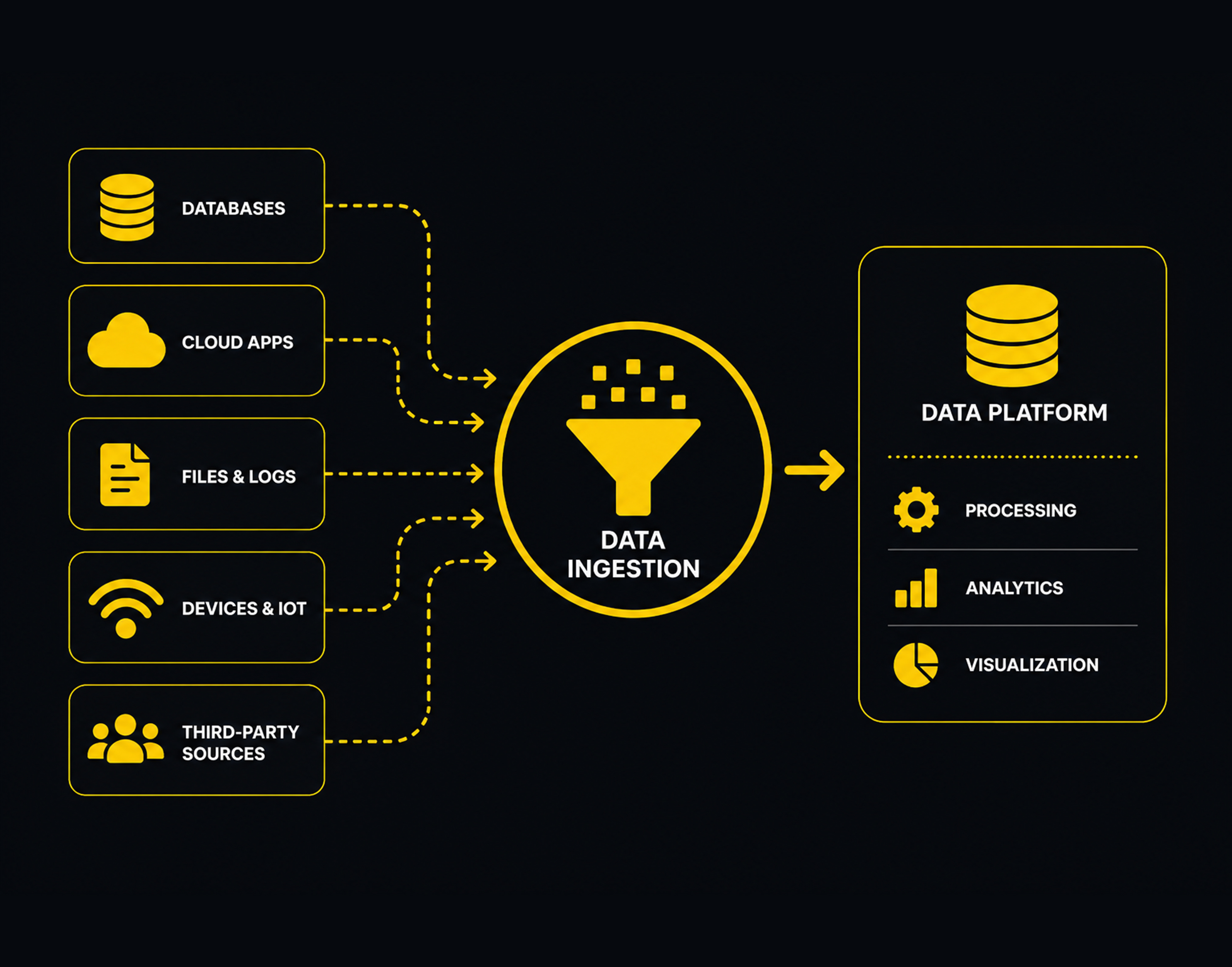
Ingest Your Data
Upload geophysics, geochemistry, or PDF assay reports. TerraPulze auto-detects CRS,
kriging grids, and column maps — no pre-processing needed.
XYZ · CSV · GRD · PDF
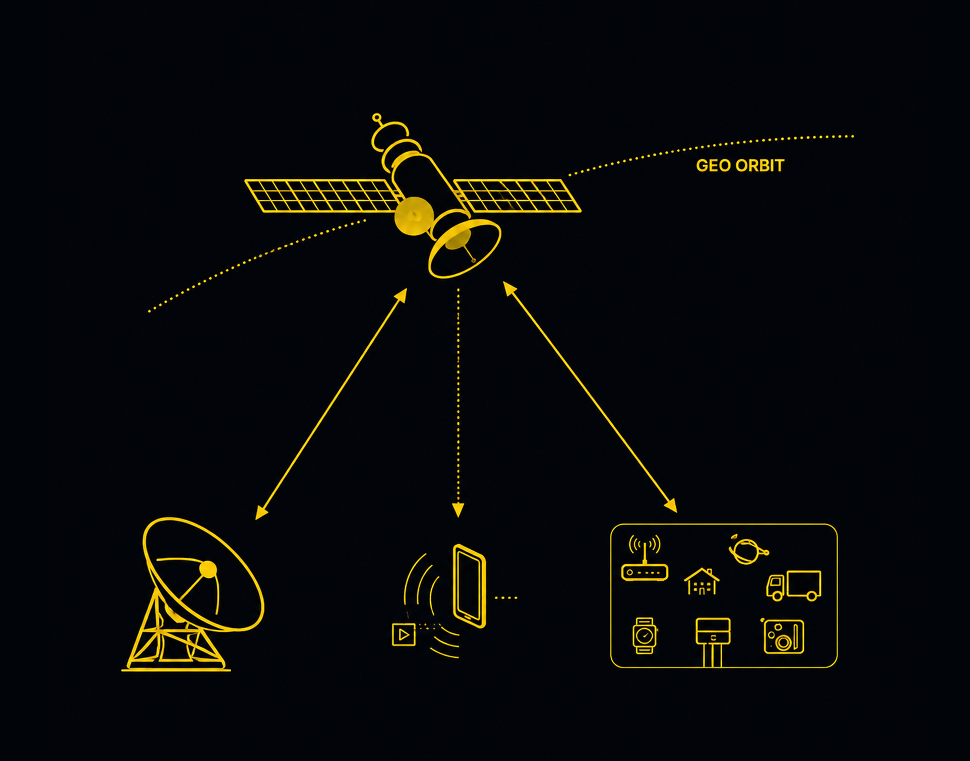
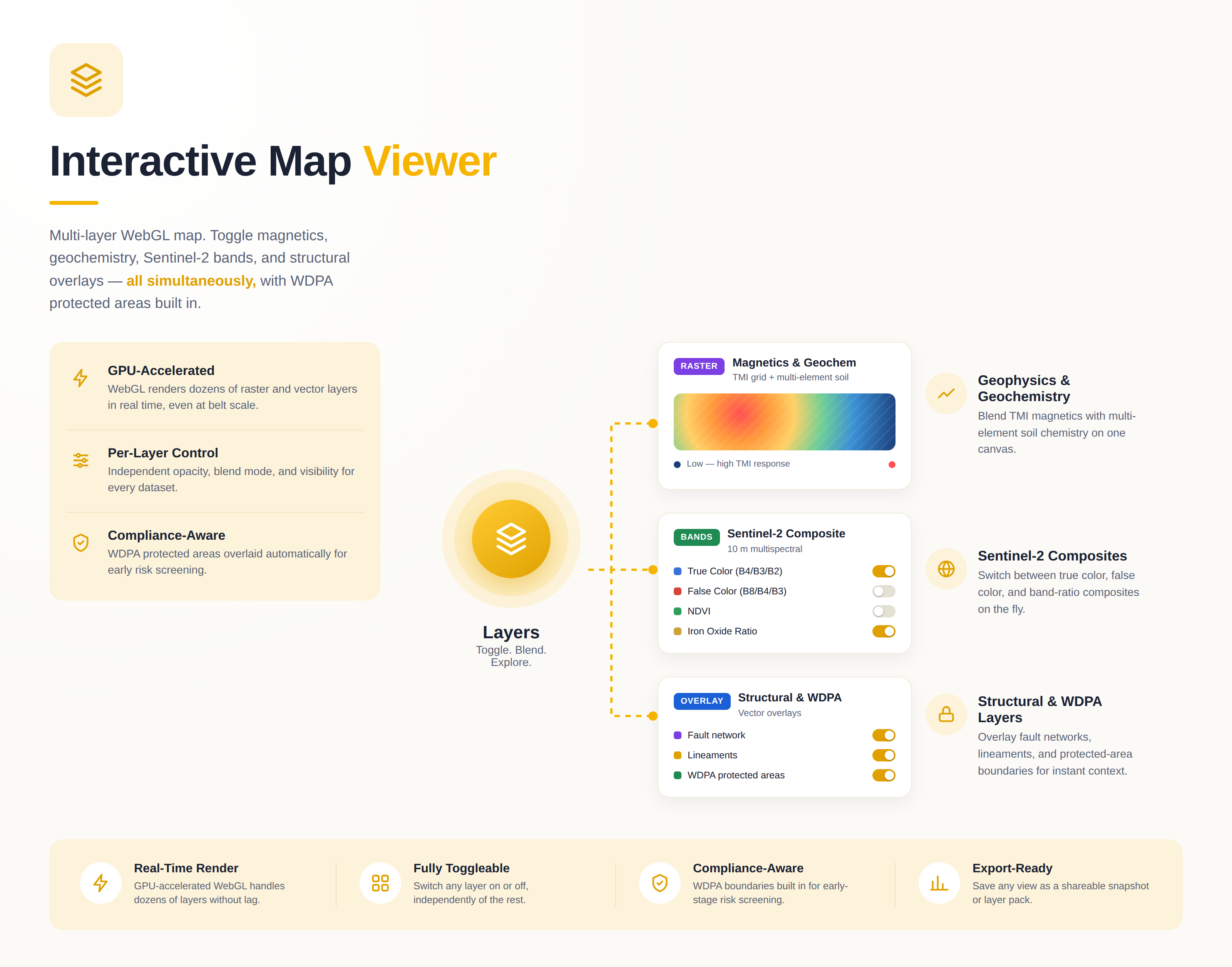
02
Fetch Satellite Context
One click triggers Sentinel-2 SWIR pull for your AOI. Structural lineaments, alteration
halos, and iron oxide anomalies are auto-mapped.
Sentinel-2 · SWIR · NDVI
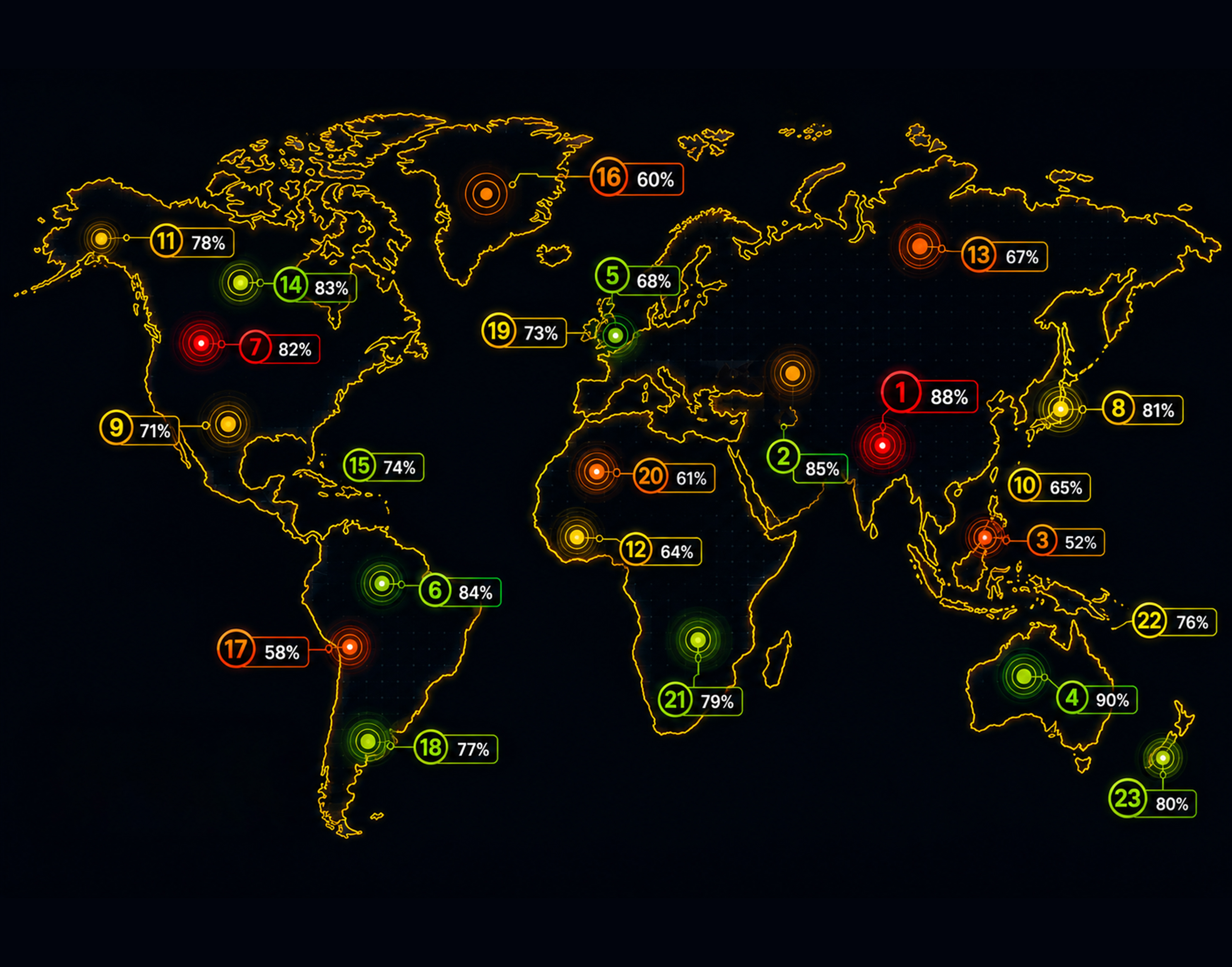
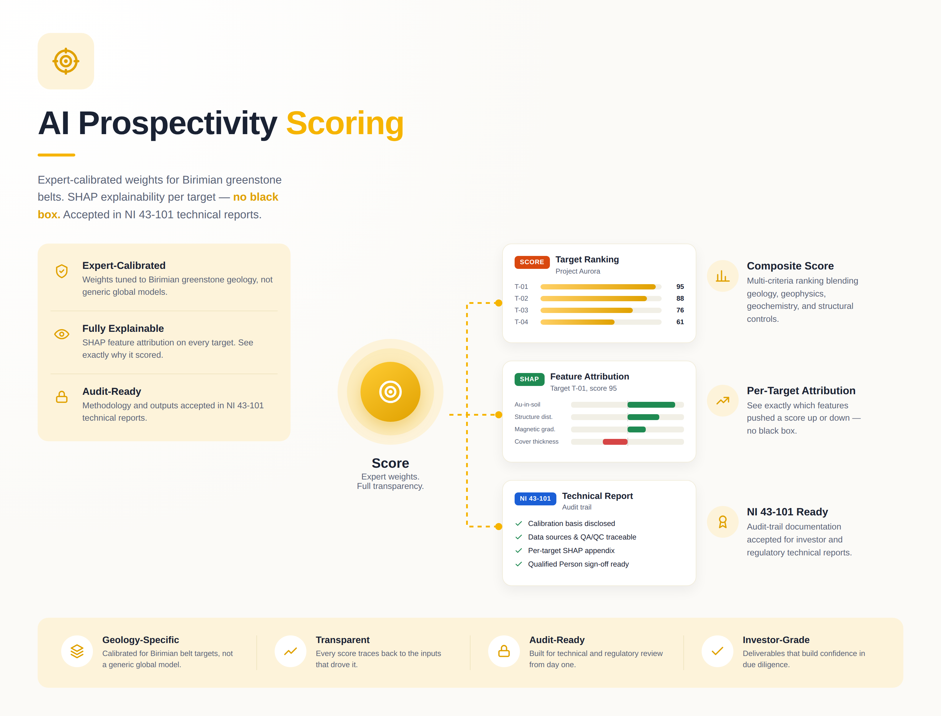
03
AI Scores Targets
Expert-weighted feature matrix — magnetics, geochem, structure, alteration — ranked
with SHAP explanations per target.
SHAP · NI 43-101
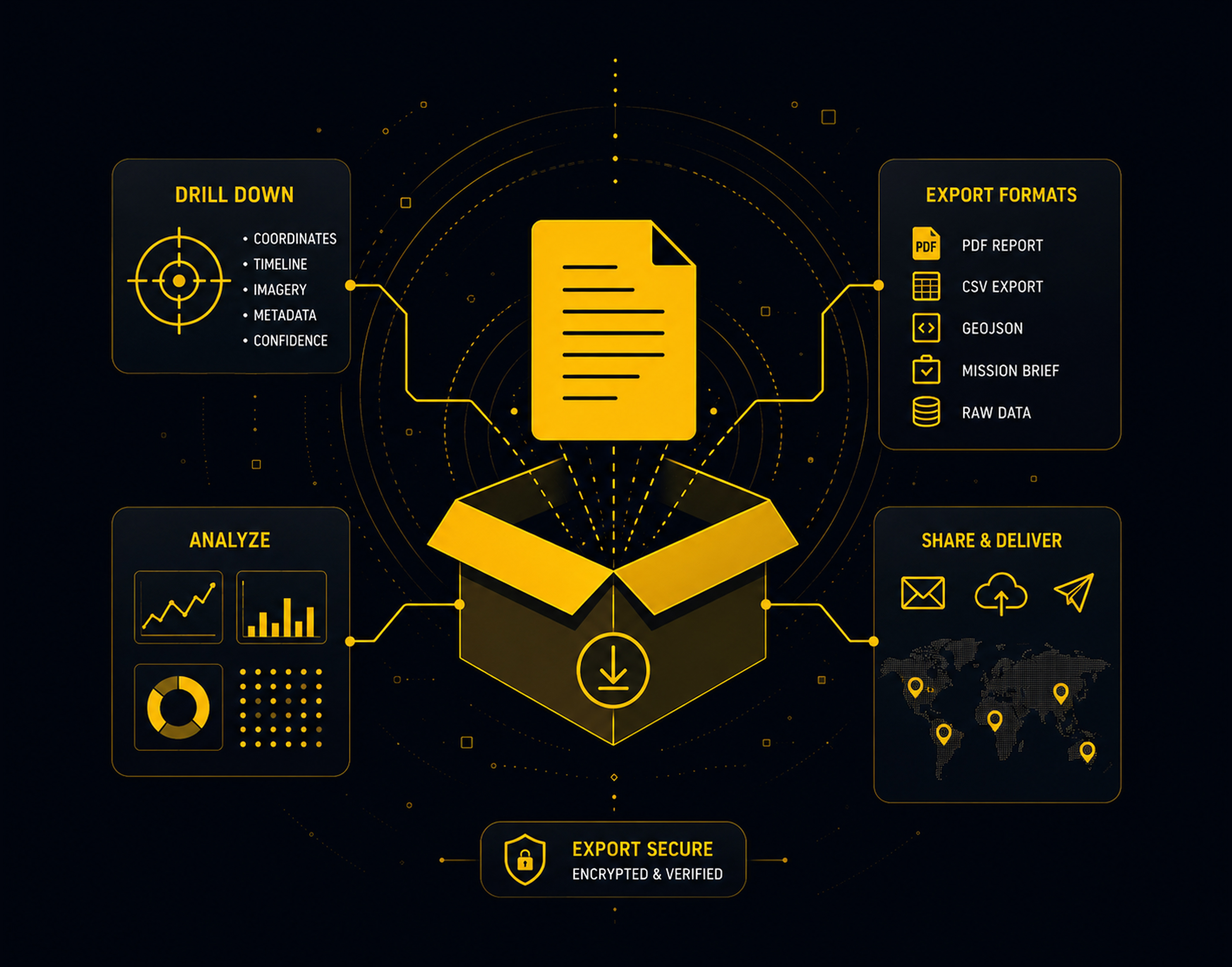
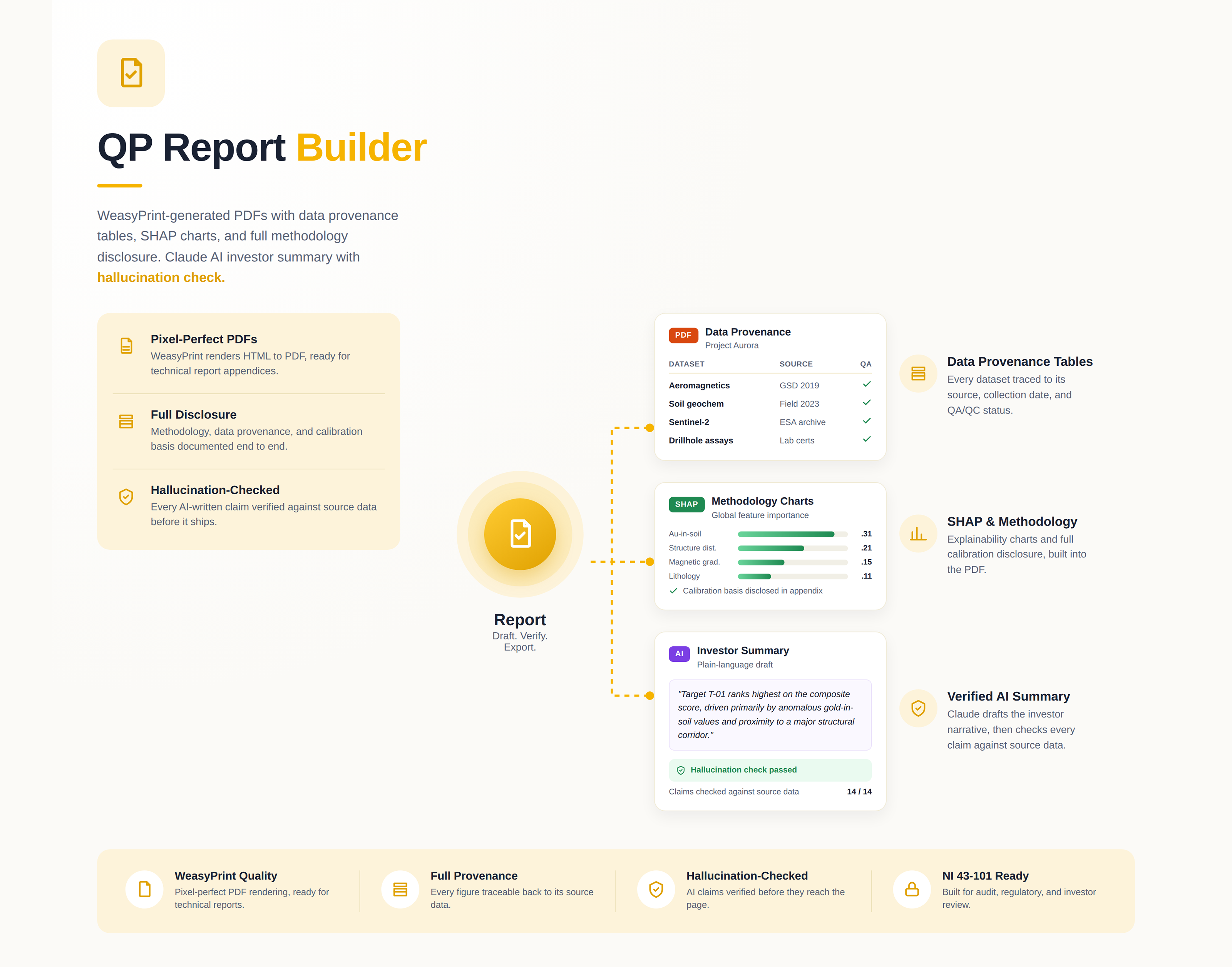
04
Export
Generate a QP-ready PDF prospectus, investor plain-language summary, or QGIS package
with shapefiles and COG rasters in one click.
PDF · QGIS · KML · CSV